


PROPERTIES OVERVIEW
General Location
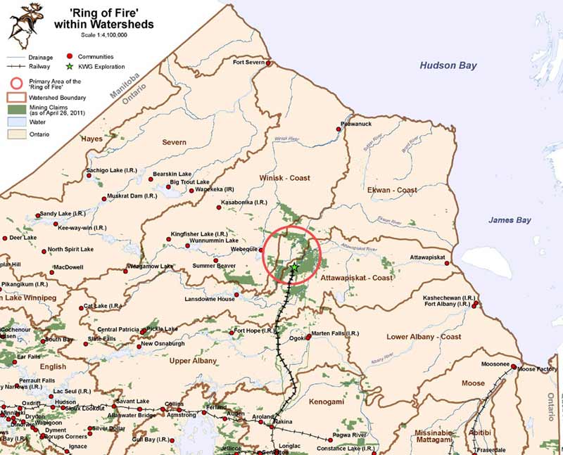
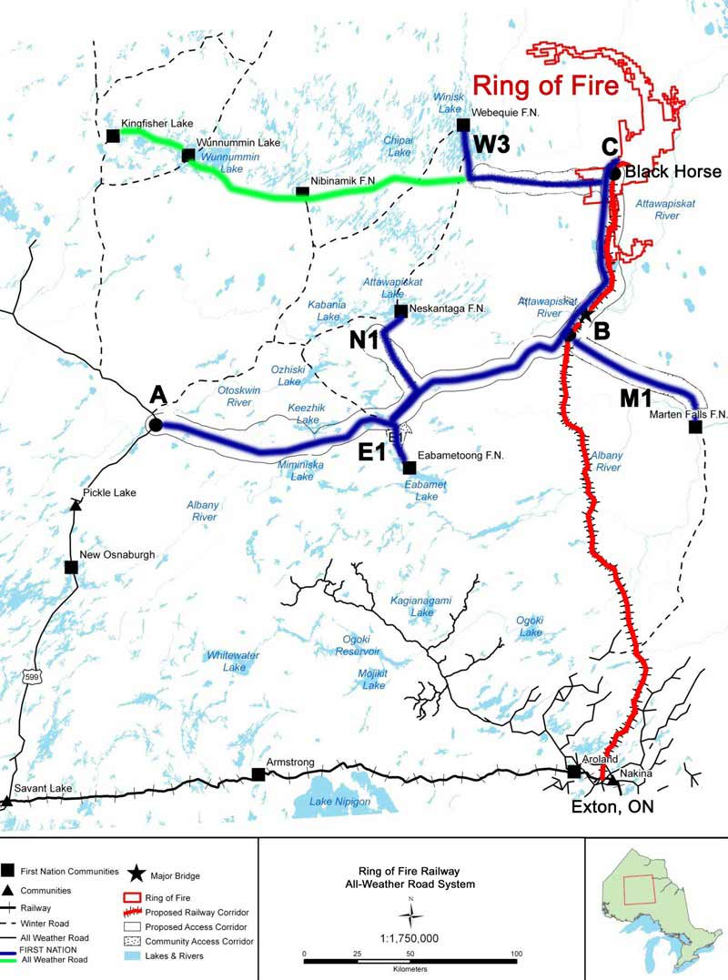
The discovery of copper-zinc mineralization at McFaulds Lake in 2002 prompted a staking rush that was guided by the magnetic fabric of the area (Figures 1 and 2) which distinguishes the prospective mafic intrusions and associated volcanic belts from barren granites. The combined staking defined a west facing arc, or inverse C pattern with a 60 kilometer diameter that was later dubbed the “Ring of Fire”. The northern boundary of a rectangular map that would cover the Ring of Fire is at latitude 53’20”, the southern boundary at 52”30”, the western boundary at longitude 87”30”, and eastern boundary at 85’30”. That portion of the Ring of Fire that has been subjected to advanced exploration leading to the discovery of a high density of a variety of mineral deposit types is confined to the southern limb of the arc, an area of about 600 square kilometres that contains most of the properties that KWG has an interest in (Figure 3). The area containing all the proposed mining developments is about 40 square kilometers. This development area is 320 kilometers north of the CN rail at the town of Nakina which is also at the northern termination of paved highway (Figure 4). The closest major urban centre is the city of Thunder Bay, 500 kilometers to the southwest. There are several First Nation communities near the Ring of Fire, Webequie being 80 kilometres west of the proposed developments and Marten Falls 160 kilometers southeast. The proposed development area falls mostly within the traditional territory of the residents of Marten Falls. Both communities are serviced by winter roads and all weather airstrips. The proposed development is at the same latitude as DeBeers Victor Mine, 200 kilometres to the east, and Goldcorp’s Musselwhite mine, 300 kilometers to the west (Figure 4).

Figure 1

Figure 2

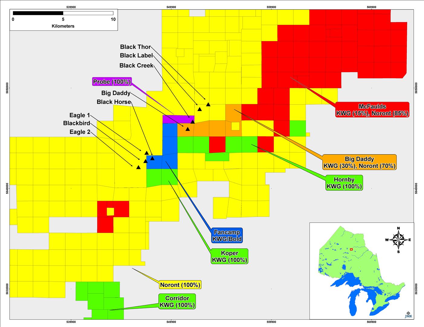
Figure 3

Figure 4
General Geology
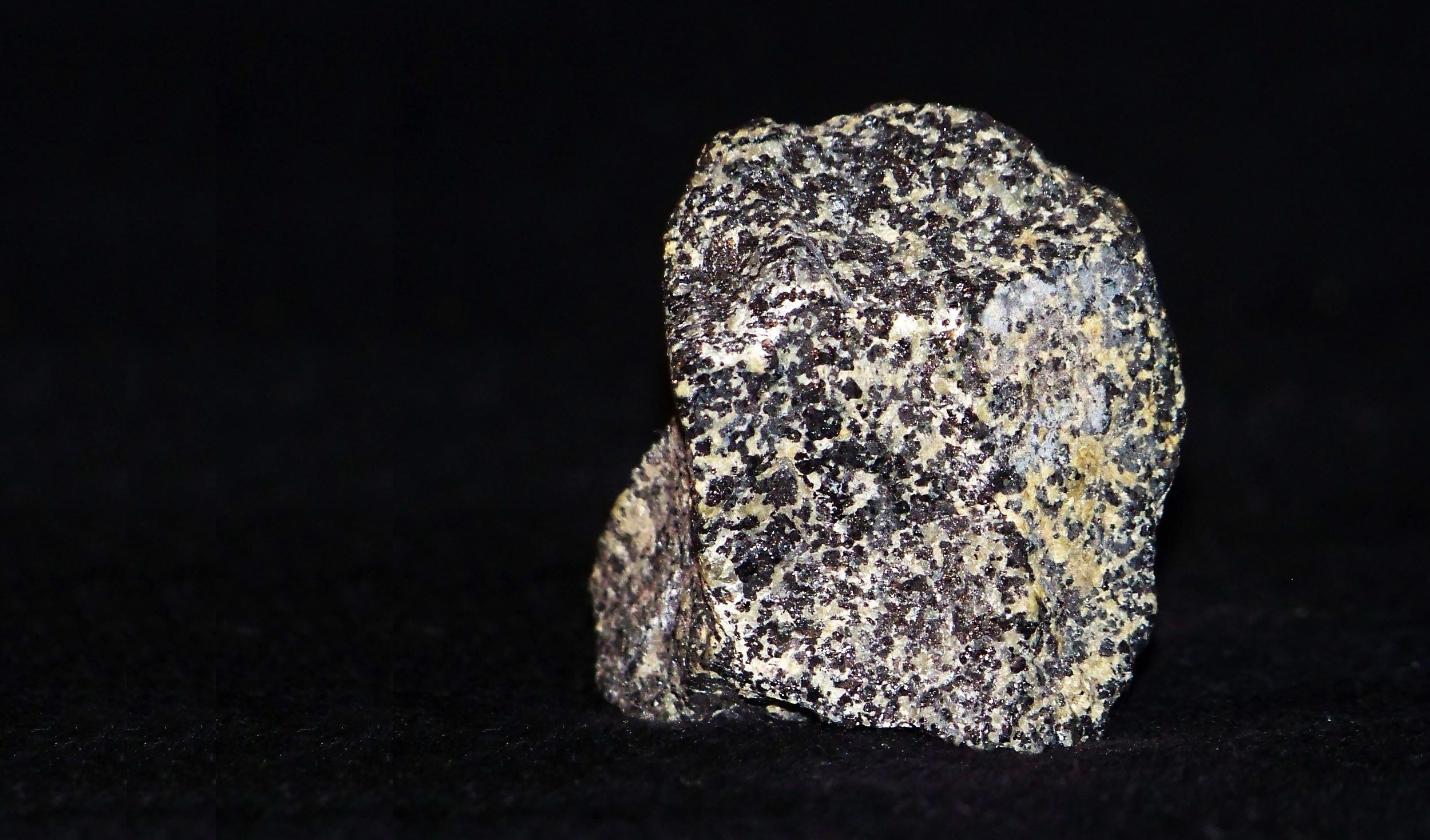
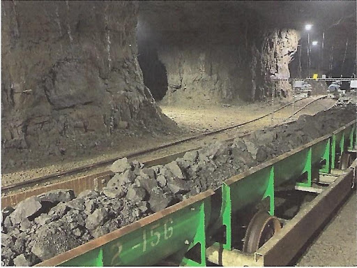
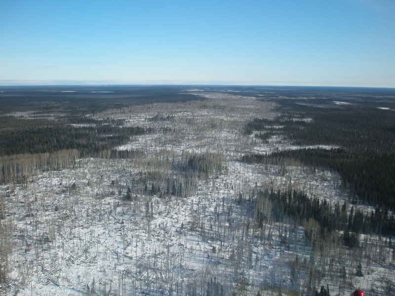
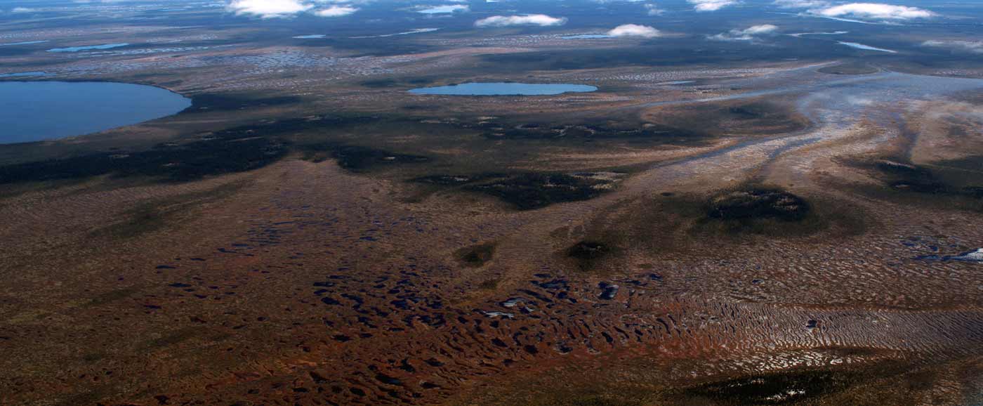
The mineral deposits discovered in the Ring of Fire are hosted by 2.7 billion year old Canadian Shield “basement” rock, specifically within remnants of volcanic belts, usually referred to as “greenstone belts” that include the very important feeder magma chambers that are host to chromite and nickel-copper deposits (Figure 5). These greenstone belts tend to be wrapped around and squeezed in between granitic batholiths which represent greater than 80% of all basement rock. The Ring of Fire straddles the boundary between the Canadian Shield and the James Bay Lowlands where it is covered by a flat lying veneer of much younger limestones that were deposited when much of North America was submerged in a shallow sea some 500 to 170 million years ago. Subsequent erosion of the flat lying rock once the continent emerged from the sea, largely by continental glaciers, resulted in flat topography and poorly defined drainage towards James Bay. This condition was further exacerbated during the last ice age which emanated from James Bay. Upon melting of the glaciers 10,000 years ago, there remained several layers of clay rich boulder till, the product of the mechanical crushing and grinding of rock underneath the moving ice sheet. The weight of the ice created a broad continental scale depression that was submerged by the glacial melt-water of post glacial Tyrrell Sea, depositing an extensive sheet of mud, occasional sandbars, and sand and gravel hills. Once the 5 km thickness of ice melted away, this water filled depression of the continental crust rebounded at a rate of 1 metre per century resulting in its shoreline receding to its present position at James Bay. This poorly drained area covered in flat lying mud promoted the growth of moss and lichens which accumulated as an extensive layer of muskeg. Thus, bedrock of the Canadian Shield in the James Bay lowlands is covered by four extensive layers; limestone, glacial till, lake-bottom mud, and muskeg. For this reason, and until recently, the James Bay Lowlands had been devoid of valuable mineral deposits. The discovery of mineral deposits in the James Bay Lowlands was made possible by extensive airborne geophysical surveys. The area first attracted diamond exploration because magnetic kimberlite pipes that pierced the non-magnetic limestone generated distinctive patterns that were tested by drilling. The mining claim that contains Noront’s Eagle One nickel-copper-platinum deposit was originally staked as a kimberlite target and drilled in 2007 subsequent to an airborne survey which revealed that an electro-magnetic conductor coincided with the magnetic anomaly, leading to the discovery of the Eagle One nickel-copper-platinum deposit, prompting a second staking rush.

Figure 5
The Ring of Fire is one of many “greenstone belts” that are a network of interconnected remnants of volcanic belts that make up about 20% of all rock in Northwestern Ontario. Prospecting is focused on greenstone belts because they host a variety of valuable metal deposits. These volcanic belts formed along major crustal sutures, or tectonic zones, often in between or on the margins of colliding continental crust. These sutures, which are fault zones that extend to the base of the crust serve as pathways for rising magmas, particularly magmas with origins in the upper mantle that retain their high metal content in solution. As these magmas ascend to lower confining pressures closer to surface, the narrow pathways expand to form magma chambers. If at this juncture the magma assimilates some of the surrounding rock, especially sulfur rich rock, thereby changing the magma chemistry, the metals contained can no longer be kept in solution as they combine with other elements to form heavy minerals that rain downwards in the chamber to concentrate either as suspended layers, or to pool at the bottom of the chamber. These minerals are mostly varieties of iron-nickel-copper sulphides and iron-titanium-vanadium-aluminium-chromium oxides. In some situations, where the chamber is subjected to additional and transient pressures created within the tectonic zone, portions of the magma, sometimes the metal enriched portions, are squeezed outwards, often upwards into channelways that eventually feed another chamber closer to surface. This may be the case for both the nickel sulphide and chromite accumulations in the Ring of Fire.
Magmas eventually reach surface to become volcanic lava. It is very likely that the Ring of Fire Intrusion is the source of magma for the volcanic rocks of the Ring of Fire. This magma chamber also played an important role in the creation of the McFaulds Lake copper-zinc volcanogenic massive sulphides (VMS). Volcanogenic massive sulphides form around underwater vents, either at the sea floor, or where the vents are buried in wet sediment. Volcanic vents discharge large volumes of hot fluids, and in some cases, metal rich fluids. The source of these fluids is in large part seawater drawn downwards into the permeable volcanic pile as a result of a fluid convection cell created by a centre of hot rising fluids. As the chlorine rich seawater interacts with the permeable volcanic rock it strips many metals, especially sulphur, copper, zinc and silver. The heat source needed to drive this convection is an underlying magma chamber, in this case the Ring of Fire intrusion. Thus, the deep intrusion hosted nickel-copper sulphides and chromium oxides are related to the near surface copper-zinc sulphides.
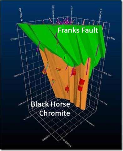
The tectonic forces that created the crustal sutures that facilitated magmas to rise through the crust are maintained for the 10’s of millions of years that the volcanic belts are active. This force will impose itself on the newly created rock, including the now cooled and crystallized magma chambers. This “stress” forces large blocks of rock to move in different directions with respect to each other. Rock along the boundaries of these blocks are either crushed to produce fault rock, or deformed plastically to form shear zones. This is the case in the Ring of Fire. The crustal suture that facilitated the rise of magma that became the Ring of Fire Intrusion continued to be active, resulting in displacement of blocks of rock along faults/shears. Drilling by various companies on their properties intersected highly sheared rock leading to an interpretation that a major shear affected the Ring of Fire Intrusion along most of its length. The impact of this shear zone on the understanding of the geology of the Ring of Fire was not fully understood until Bold Ventures Inc. (“Bold”) and KWG began drilling on the Fancamp Claims in 2013. A full description of that program can be found in the Fancamp Claims section below. Drilling during that program intersected a distinct major shear zone 15 times, from near surface to a depth of 1 kilometer. These 15 intercepts defined a tightly constrained northeast trending plane inclined at 60 degrees to the west which coincided with the upwards termination of the Black Horse chromitite, an obvious fault truncation which was labelled Frank’s Fault. A re-examination of all previous drill logs on the Fancamp and Big Daddy claims traced the fault northeastwards through the southern termination of the Big Daddy chromitite. This led to an interpretation that the Big Daddy chromitite is the fault offset twin of the Black Horse. As such, the block on the northwest side of the northeast trending shear has moved 4 to 6 kilometers horizontally with respect to the block on the southeast side. The block on the northwest side contains the Black Thor and Big Daddy deposits, while the block on the southeast side contains the Blackbird and Black Horse deposits. This interpretation explains why there is a 4 kilometer gap of the chromitite of which the majority is on the Fancamp Claims, and a portion on the Hornby property. This gap only exists in the near surface as the Black Horse chromitite is interpreted to be present beneath Frank’s Fault across the Fancamp claims.
Frank’s Fault is typical of shear zones – deformation zones that are found in all greenstone belts, and often serve as pathways for hydrothermal fluids that create gold deposits. Based on descriptions and maps, Noronts Triple J gold occurrence is the on strike extension of Frank’s Fault. Gold was also discovered in some of the drill holes on the Fancamp claims and near the southern termination of the Big Daddy.
In summary, it’s not a coincidence that Massive Magmatic Sulphide deposit, Volcanogenic Massive Sulphide deposits, and gold mineralization are found in close proximity in the Ring of Fire. These deposits are all the by-products of the same mantle tapping crustal fissures.